Trekking trails in Sauris
Discover the many picturesque aspects of the landscape that characterize the nature around Sauris by choosing your favorite route from those proposed. The trails we present are always customizable: based on your imagination and level of experience, you can choose to walk them in a loop, in a reverse direction, or by combining several trails together.
The complete map of Sauris trails is available in both a paper version, which can be picked up at the tourist office in Sauris di Sotto, and in a digital version (pdf).
Download the map in PDF
You can also download and view an itinerary on your mobile devices through navigation applications that support GPX or KML formats. By selecting your trail of interest on the map below, you can download the corresponding data by clicking on the “download GPX/KML” link in the detail tab, and read it with one of the free smartphone apps.
Trail descriptions
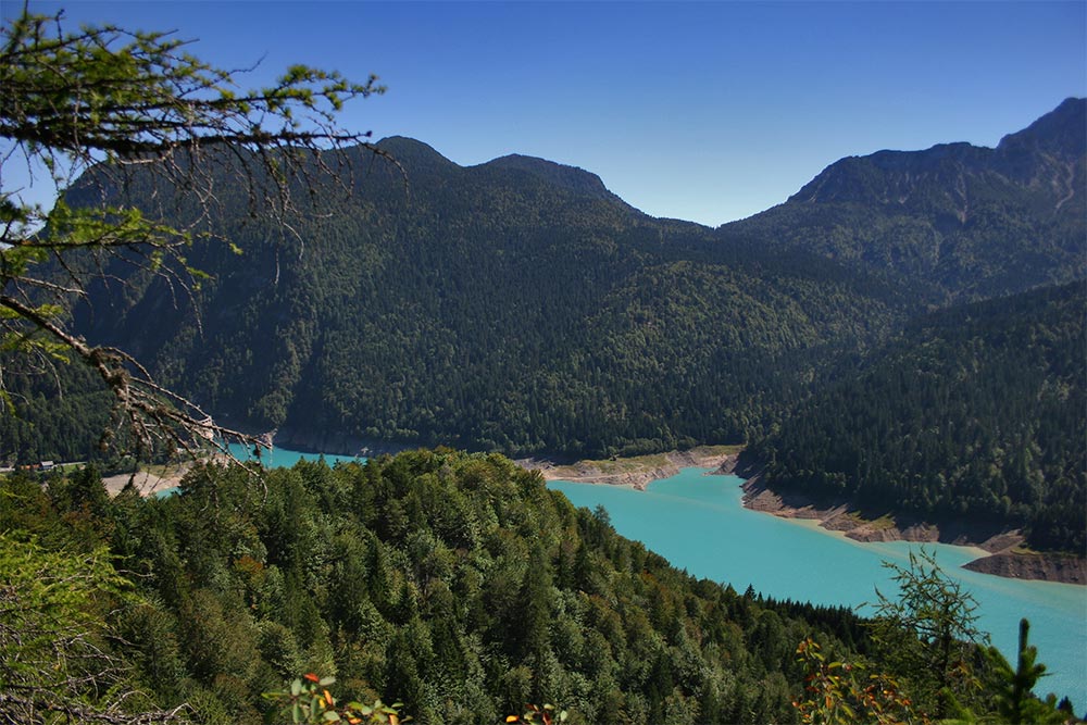
Magic between the lake and Monte Ruke
Despite its artificial origin, Lake Sauris has a characteristic turquoise color, which changes depending on the color of the sky; it represents an element of remarkable naturalistic splendor, widely appreciated along the first group of trails.
> 1A / INACCESSIBLE
Monte Ruke
Distance: 4.33 km
Estimated time: 02h:00′:42″
Total ascent: ⬈ 485 m
Total descent: ⬊ -109 m
Difficulty level: Difficult
Details
> 1B
Hinterseike-Pehrvole
Distance: 1.88 km
Estimated time: 00h:44′:47″
Total ascent: ⬈ 139 m
Total descent: ⬊ -58 m
Difficulty level: Easy
Details
> 1C
Untervelt
Distance: 1.63 km
Estimated time: 00h:38′:48″
Total ascent: ⬈ 119 m
Total descent: ⬊ -50 m
Difficulty level: Easy
Details
> 1D
La Maina – Pamelouche Mulini
Distance: 9.46 km
Estimated time: 03h:46′:35″
Total ascent: ⬈ 731 m
Total descent: ⬊ -311 m
Difficulty level: Moderate
Details
> 1E / INACCESSIBLE
Unterankhlopfe
Distance: 1.67 km
Estimated time: 00h:40′:50″
Total ascent: ⬈ 0 m
Total descent: ⬊ -282 m
Difficulty level: Moderate
Details
> 1F / INACCESSIBLE
Hintermeruke
Distance: 2.08 km
Estimated time: 00h:48′:01″
Total ascent: ⬈ 10 m
Total descent: ⬊ -320 m
Difficulty level: Difficult
Details
> 1G / INACCESSIBLE
Ruetach
Distance: 0.73 km
Estimated time: 00h:22′:53″
Total ascent: ⬈ 114 m
Total descent: ⬊ 0 m
Difficulty level: Easy
Details
> 1H
Schotsaite
Distance: 1.47 km
Estimated time: 00h:46′:52″
Total ascent: ⬈ 290 m
Total descent: ⬊ -37 m
Difficulty level: Difficult
Details
> 1I
Pehrvole
Distance: 1.15 km
Estimated time: 00h:37′:33″
Total ascent: ⬈ 206 m
Total descent: ⬊ -15 m
Difficulty level: Moderate
Details
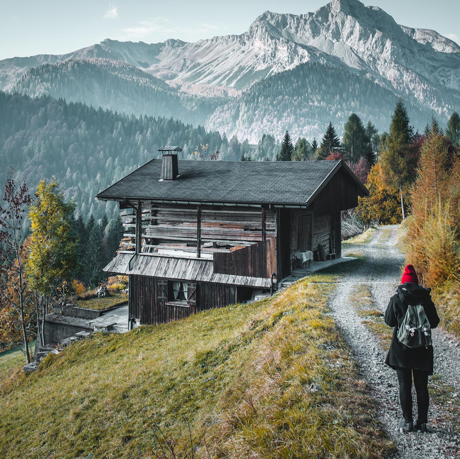
The system of “Stavoli”
Stavoli are rural buildings made of wood and stone used for storing hay and sheltering livestock. Often attached to these structures were home dwellings that were built on meadows at moderate altitudes and could be reached through a dense network of trails and cartways.
> 2A
Eimblateribn
Distance: 2.96 km
Estimated time: 01h:27′:05″
Total ascent: ⬈ 352 m
Total descent: ⬊ -142 m
Difficulty level: Easy
Details
> 2B
Hinterdolbe
Distance: 3.19 km
Estimated time: 01h:04′:40″
Total ascent: ⬈ 105 m
Total descent: ⬊ -116 m
Difficulty level: Easy
Details
> 2C
Monte Olbe
Distance: 2.56 km
Estimated time: 01h:16′:53″
Total ascent: ⬈ 278 m
Total descent: ⬊ -187 m
Difficulty level: Moderate
Details
> 2D / INACCESSIBLE
Scheanalaite
Distance: : 3.29 km
Estimated time: 01h:18′:35″
Total ascent: ⬈ 221 m
Total descent: ⬊ -217 m
Difficulty level: Moderate
Details
> 2E
Hozach
Distance: 2.44 km
Estimated time: 00h:52′:29″
Total ascent: ⬈ 97 m
Total descent: ⬊ -134 m
Difficulty level: Easy
Details
> 2F
Mot
Distance: 3.49 km
Estimated time: 02h:08′:05″
Total ascent: ⬈ 676 m
Total descent: ⬊ -276 m
Difficulty level: Moderate
Details
> 2G
Klomenstaighele
Distance: 1.7 km
Estimated time: 00h:46′:53″
Total ascent: ⬈ 56 m
Total descent: ⬊ -248 m
Difficulty level: Difficult
Details
> 2H
Straitar
Distance: 1.01 km
Estimated time: 00h:35′:26″
Total ascent: ⬈ 188 m
Total descent: ⬊ -3 m
Difficulty level: Moderate
Details
> 2L
Mitreikenpoch
Distance: 1.59 km
Estimated time: 00h:39′:58″
Total ascent: ⬈ 58 m
Total descent: ⬊ -191 m
Difficulty level: Difficult
Details
> 2M
Fuieikele
Distance: 1.79 km
Estimated time: 00h:47′:42″
Total ascent: ⬈ 140 m
Total descent: ⬊ -123 m
Difficulty level: Moderate
Details
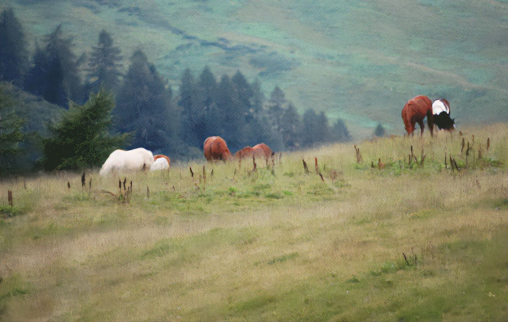
Around the Pieltinis between pastures and peaks
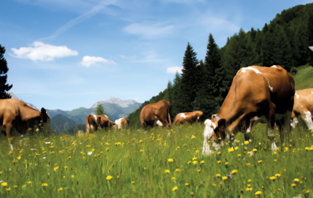
Beyond the limits of the arboreal vegetation, extensive high-altitude pastures open up, thanks to centuries of human care. Having a high quality of fodder, they allow the Alpines pastures, situated around Monte Pieltinis, to yield a unique production of dairy products.
> 3A
Temberle – Pieltinis
Distance: 4.09 km
Estimated time: 01h:44′:42″
Total ascent: ⬈ 416 m
Total descent: ⬊ -13 m
Difficulty level: Easy
Details
> 3B
Rinderperkh – Pieltinis
Distance: 2.4 km
Estimated time: 01h:18′:49″
Total ascent: ⬈ 394 m
Total descent: ⬊ -37 m
Difficulty level: Moderate
Details
> 3C
Festons – Malins – Pieltinis
Distance: 10.52 km
Estimated time: 04h:34′:22″
Total ascent: ⬈ 891 m
Total descent: ⬊ -560 m
Difficulty level: Difficult
Details
> 3D
Morgantlaite – Monte Pieltinis
Distance: 3.1 km
Estimated time: 01h:20′:17″
Total ascent: ⬈ 239 m
Total descent: ⬊ -175 m
Difficulty level: Moderate
Details
> 3E
Malga Jelma
Distance:: 1.97 km
Estimated time: 00h:56′:04″
Total ascent: ⬈ 175 m
Total descent: ⬊ -146 m
Difficulty level: Easy
Details
> 3F
Olta Hörbige
Distance: 1.99 km
Estimated time: 01h:09′:28″
Total ascent: ⬈ 380 m
Total descent: ⬊ -57 m
Difficulty level: Moderate
Details
The charm of Val Novarza
There are places where time takes on a different flow, more in harmony with the rhythm of nature. While this sensation is felt only after a first impact from the entire Sauris basin, in the Val Novarza the perception is rather immediate.
> 4A
Malga Losa
Distance: 3.9 km
Estimated time: 01h:30′:05″
Total ascent: ⬈ 284 m
Total descent: ⬊ -14 m
Difficulty level: Easy
Details
> 4B
Hinter Frumeibn
Distance: 1.56 km
Estimated time: 00h:57′:08″
Total ascent: ⬈ 271 m
Total descent: ⬊ -501 m
Difficulty level: Moderate
Details
> 4C
Malga Novarzutta
Distance: 1.66 km
Estimated time: 00h:59′:16″
Total ascent: ⬈ 333 m
Total descent: ⬊ 0 m
Difficulty level: Moderate
Details
> 4D
Veltrpoch
Distance: 2.15 km
Estimated time: 00h:36′:47″
Total ascent: ⬈ 3 m
Total descent: ⬊ -167 m
Difficulty level: Easy
Details
Discover who “adopts a trail” in Sauris
For many years in Sauris, local associations and hospitality and production facilities, along with individual volunteers, have been supporting the Municipal Administration by each taking care of an individual trail. It’s an innovative and participatory way to ensure the regular annual maintenance of the valley’s network of trails, while assuring residents and tourists ideal accessibility of these routes dedicated to exploring the territory of Sauris.
The municipal initiative “Adopt a Trail” is made possible thanks to the collaboration of:
TOURISM OPERATORS: Albergo Diffuso Sauris, Albergo Ristorante Riglarhaus, Azienda Agricola Bianco Sauris, Azienda Agricola Pa’ Mairlan, Legnostile F.lli Plozzer, Malga Alta Carnia, Meublè Pa’ Khraizar, Prosciuttificio Wolf Sauris, Birrificio Zahre Beer;
ASSOCIATIONS AND INDIVIDUALS: Associazione Pescatori Sauris, Coro Zahre, Gruppo A.N.A. Sauris, Pro Loco Sauris Zahre, Sci Club Sauris, Soroptimist Club Udine and Mario Lucchini.